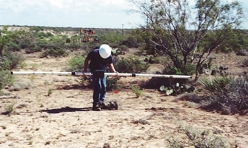
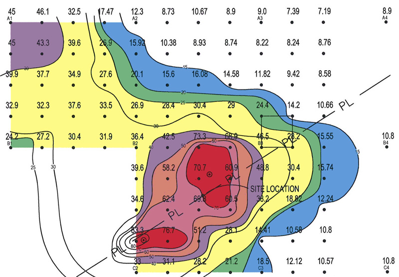
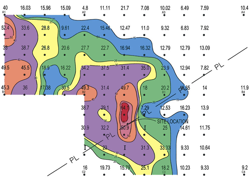
EM surveys evaluate chemical releases to soil and groundwater by determining the electrical conductivity based on rock type, porosity, permeability, and composition of fluid in pore spaces. The EM technique is proven in:
- Delineating produced water releases
- Mapping subsurface features and terrain contacts
- Locating abandoned oilfield pits, even where the surface has been reclaimed by vegetation